01
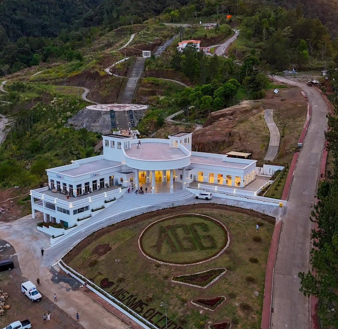
Asenso Global Gardens
Barangay Hoyohoy, Tangub City, Misamis Occidental, Region X

Discover the natural wonders, rich traditions, and vibrant communities that make our province truly special. Come and experience the magic of Misamis Occidental!
The most sought-after spots this season.
Uncover the diverse landscapes of Misamis Occidental. From sun-drenched coasts to ancient highlands, our curated collection takes you through every hidden gem this province has to offer.
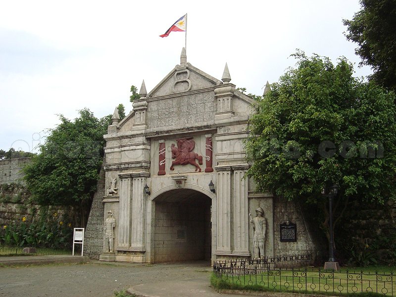
A historic 18th-century Spanish stone fort (Fuerte de la Concepción y del Triunfo) built in 1756 along the coast of Ozamiz City to protect Panguil Bay against pirate raids. Declared a National Cultural Treasure, it houses an official museum displaying colonial artifacts, military relics, and regional history exhibits.
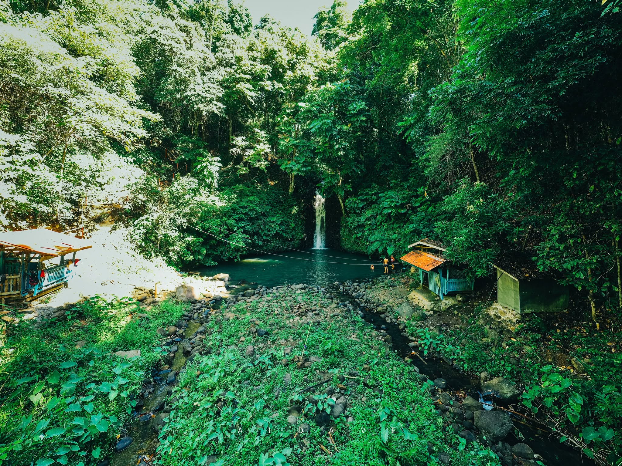
A hidden natural waterfall surrounded by dense tropical foliage, lush greenery, and fresh mountain air in Oroquieta City. Reached via a scenic concrete staircase trail of over 300 steps down to the natural cold swimming basin.
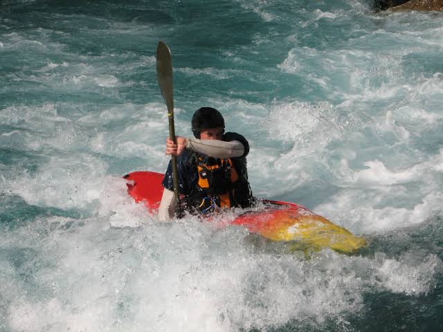
An eco-adventure mangrove paddling tour along the river streams and coastal mangrove estuaries of Oroquieta City. Provides visitors with guided mangrove kayaking experiences, ecological education, and river swimming.
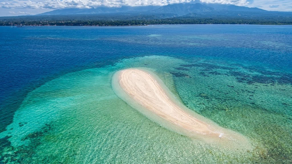
A unique marine sandbar situated off the coast of Jimenez. Named after its distinct tadpole/sperm-like shape visible from above, it emerges during low tide to provide clear turquoise waters for swimming, sunbathing, and beach picnics.
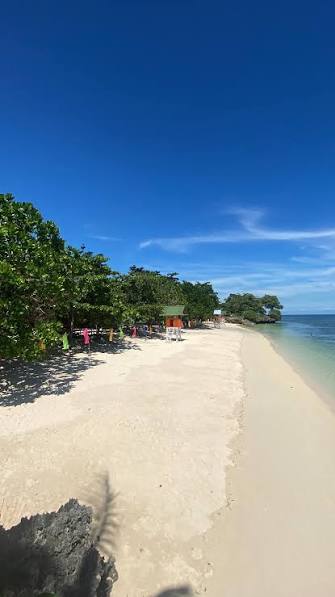
A beachfront resort along the coastal stretch of Baliangao featuring white sand beach areas, turquoise waters, open-air picnic cottages, volleyball court facilities, and room accommodations.
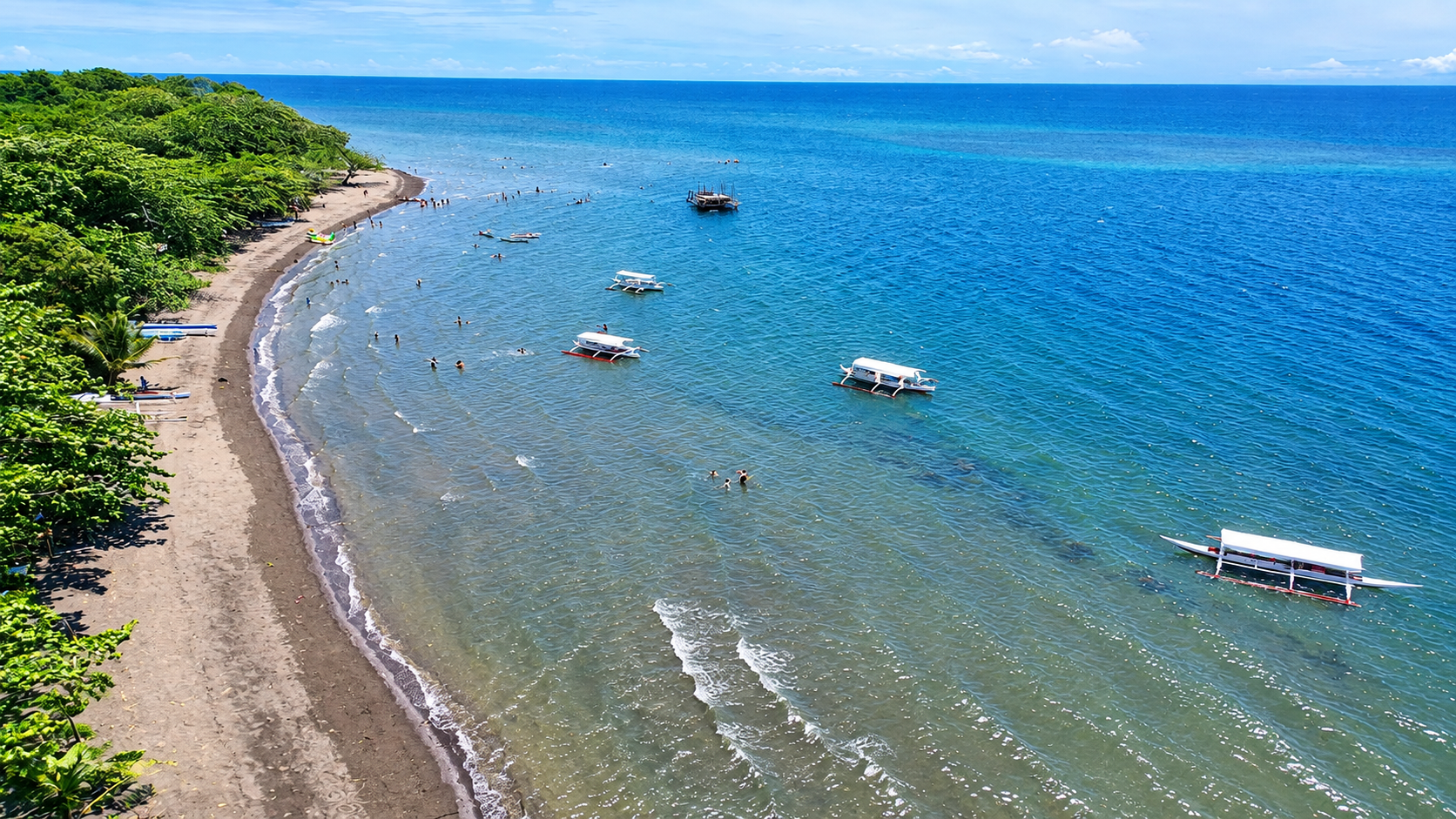
A natural public coastal shoreline in the municipality of Panaon, popular among locals for weekend swimming, beach picnics, and relaxing seaside walks.
3 destinations
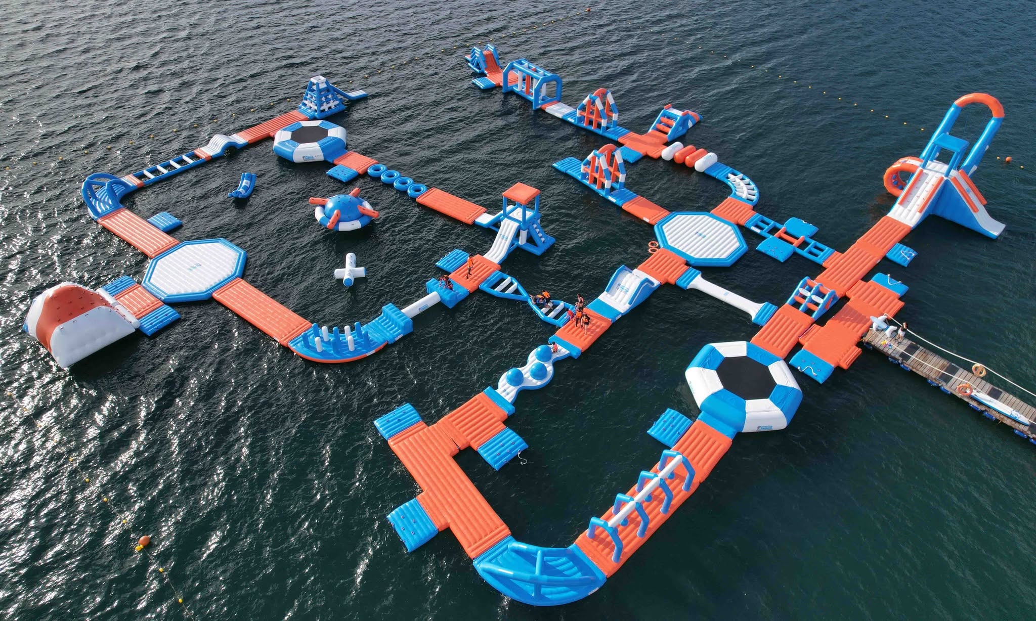
A major 3,500-square-meter inflatable water park located in Caluya Bay. Features over 30 inflatable obstacle courses including giant slides, Tarzan swings, human launchers, trampolines, and climbing walls.
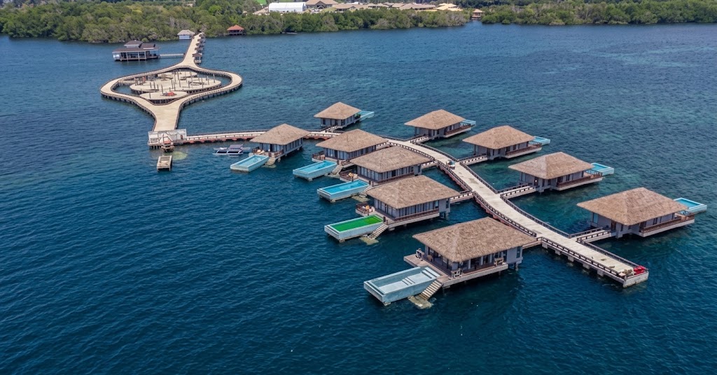
A major provincial flagship coastal eco-tourism and adventure park complex. It offers large swimming pool amenities, sports facilities, a coastal boardwalk, dining outlets/restaurants, events facilities, and recreational/adventure spaces along Panguil Bay.
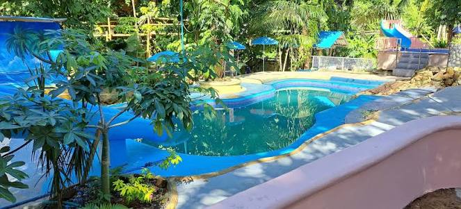
An adventure campsite and rock formation park in Sinacaban offering glamping tents, designated camping grounds, rock climbing features, and scenic nature views.
28 destinations
A unique marine sandbar situated off the coast of Jimenez. Named after its distinct tadpole/sperm-like shape visible from above, it emerges during low tide to provide clear turquoise waters for swimming, sunbathing, and beach picnics.
A beachfront resort along the coastal stretch of Baliangao featuring white sand beach areas, turquoise waters, open-air picnic cottages, volleyball court facilities, and room accommodations.
A natural public coastal shoreline in the municipality of Panaon, popular among locals for weekend swimming, beach picnics, and relaxing seaside walks.

Panguil Bay Bridge is a major landmark connecting Tangub City, Misamis Occidental, with Tubod, Lanao del Norte. The bridge spans approximately 3.17 kilometers across Panguil Bay and was officially opened to traffic in September 2024. It has become an important landmark and gateway between the two provinces.
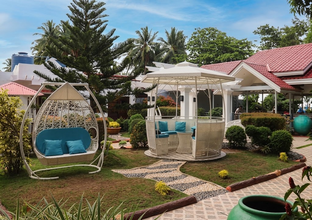
A coastal hotel resort in Jimenez featuring guestroom accommodations, freshwater swimming pools, open-air seaside pavilions, and function spaces for weddings, birthdays, and corporate events.
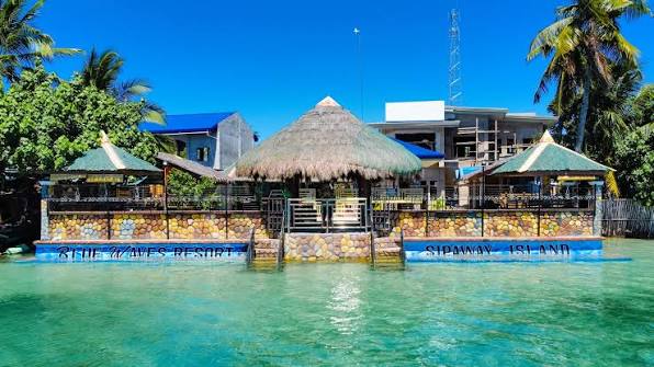
A beach resort in Clarin featured in local tourism listings, providing open-air beachfront huts, swimming facilities, overnight rooms, and spaces for social gatherings.
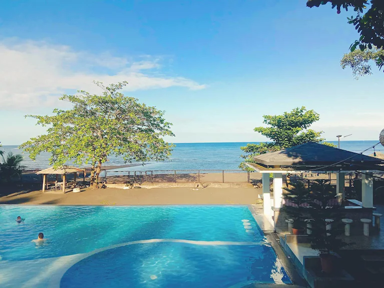
A multi-level coastal beachfront resort in Panaon featuring an outdoor swimming pool, air-conditioned rooms, pet-friendly amenities, and venue spaces for social gatherings, parties, and family reunions.

A major resort hotel along the Panaon coastline featuring guestroom accommodations, freshwater swimming pools, oceanfront dining, and function halls for weddings, corporate events, and large social gatherings.
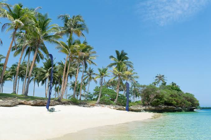
Bawbawon Island is an island destination near Plaridel, Misamis Occidental. The Department of Tourism describes the island as being surrounded by coral reef and mangrove areas, with coconut trees and natural coastal scenery.
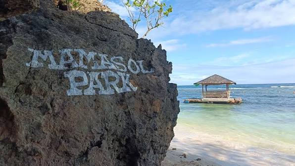
A local coastal park and beach resort area in Baliangao frequented by residents and visitors for weekend outings, seaside picnics, and casual swimming.
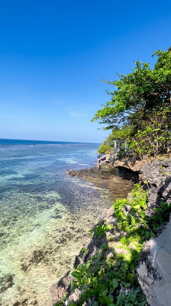
A small beachfront resort and viewing spot in Baliangao offering views across the bay, oceanfront picnic tables, and swimming access.
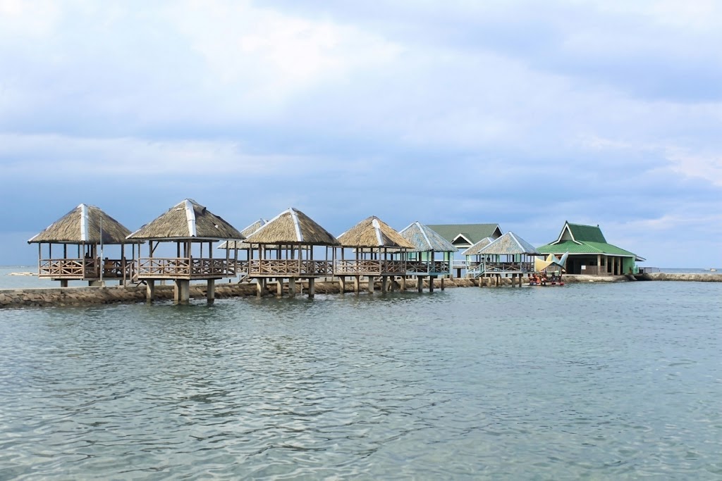
A scenic public beach and coastal bayfront area in Oroquieta City located near the DOST Provincial Center and Bayfront Arena. Features a public sandy shoreline frequented by locals for seaside picnics, casual swimming, and beach walks.
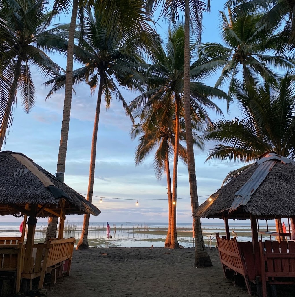
A public coastal shoreline in Plaridel located near the mouth of a local river stream, offering scenic seaside views, fresh breeze, and open picnic spaces.
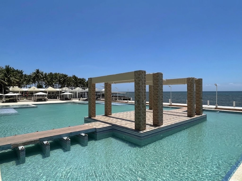
A local seaside beach resort along the Clarin coast offering day-use bamboo cottages, ocean swimming access, and simple overnight quarters.
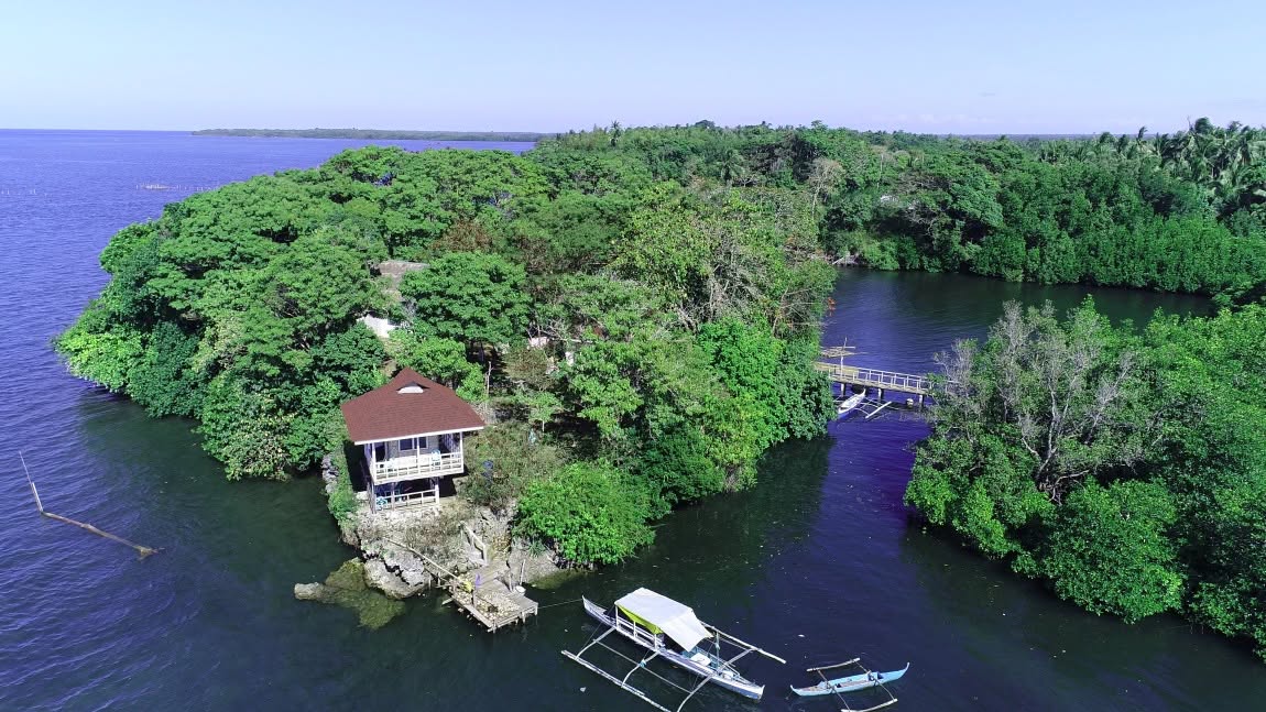
A 315.5-hectare national protected area established in Danao Bay under RA 11038 (ENIPAS Act). It encompasses a rich marine sanctuary featuring pristine mangrove forests, seagrass beds, coral reefs, sandbars, and biodiversity habitats.
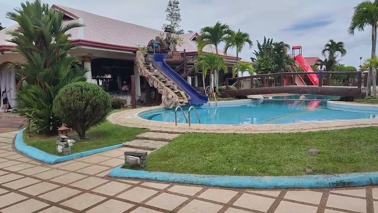
A private coastal resort hotel about 20 minutes from Ozamiz City in Clarin, featuring a swimming pool, direct sea access, air-conditioned guestrooms, function venues, and dining services.
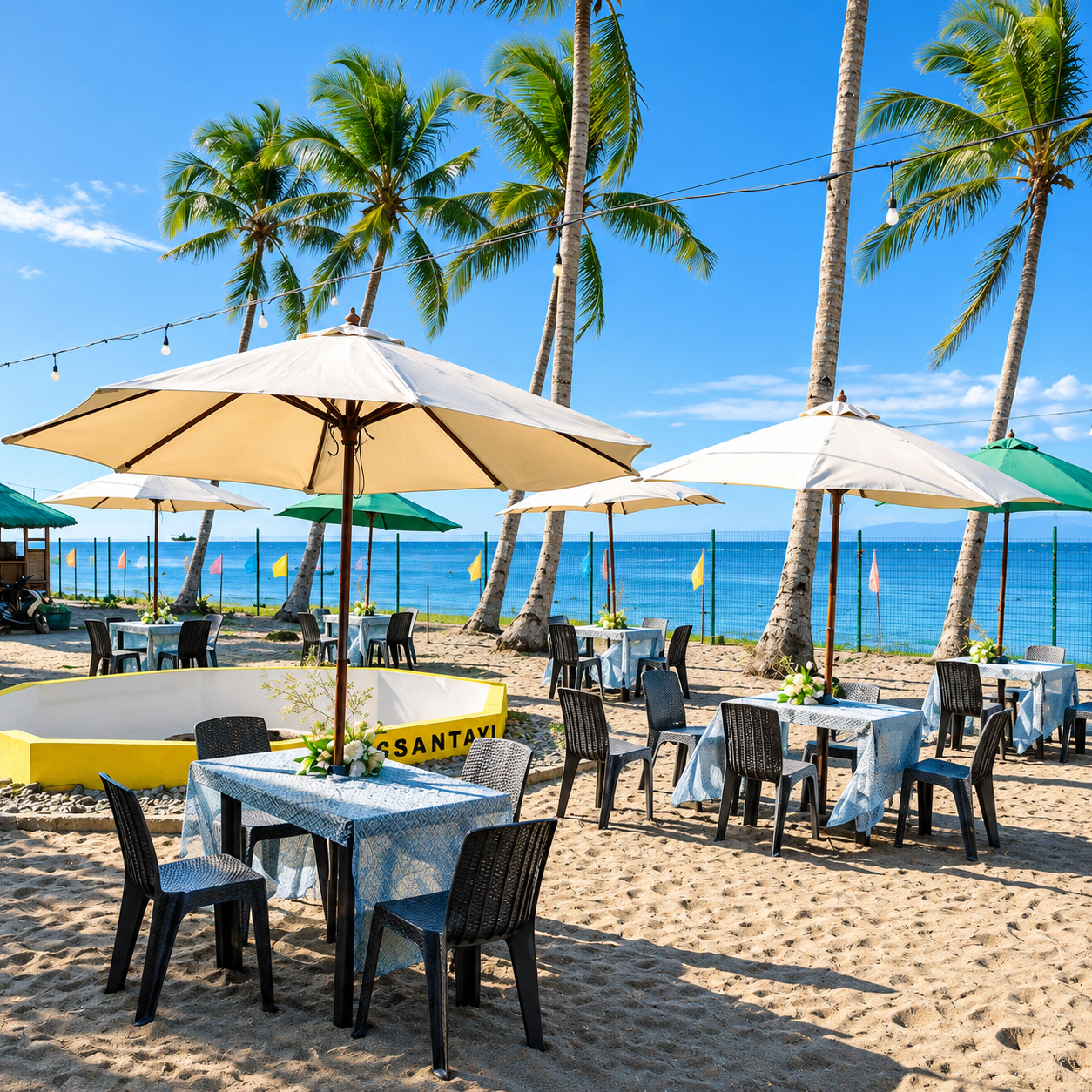
A public beach retreat and vacation townhouse area located along the Plaridel shoreline. Features sandy beaches, calm sea swimming, and family-friendly picnic amenities.
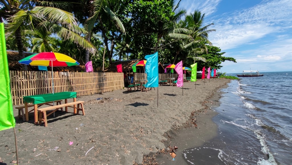
A natural public coastal beach in Plaridel frequented by local families for swimming and weekend seaside picnics.
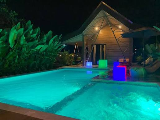
A popular coastal beach resort in Aloran featuring beachfront cottage accommodations, swimming areas, glamping options, and spaces for social gatherings and private events.

A coastal resort and seapark located near the Danao Bay / Baliangao Protected Seascape area. Features seaside cottages, calm swimming waters, venue spaces for family events, and accommodations.
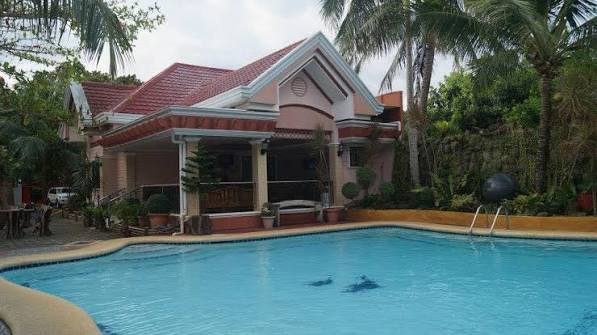
A coastal resort along the shoreline of Clarin, providing visitor cottage rentals, clear waters for casual swimming, and family stay accommodations.
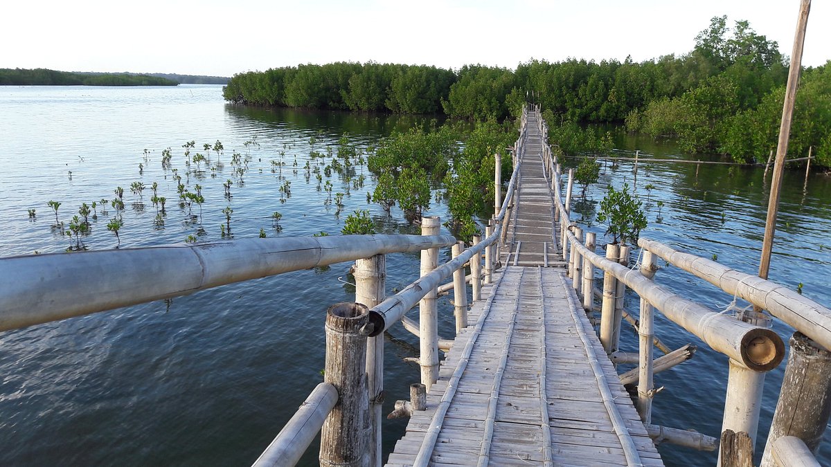
A marine protected area and mangrove eco-park located in Barangay Mobod. Features pristine mangrove channels, coastal marine biodiversity, birdwatching spots, and shallow clear waters for kayaking and swimming.
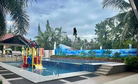
A private beachfront establishment in Clarin providing basic beach cottages, calm swimming waters along the coastline, and room accommodations for small groups and families.
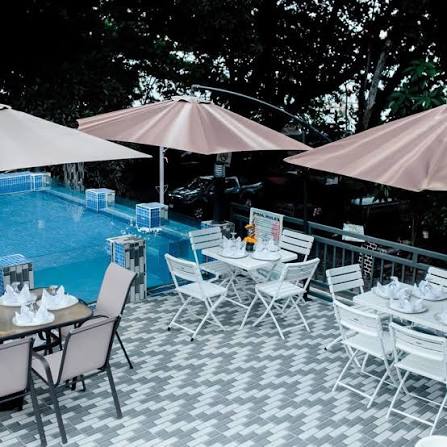
A beachfront establishment along the Panaon coast offering shaded oceanfront huts, clear waters for casual swimming, and day-tour picnic facilities.
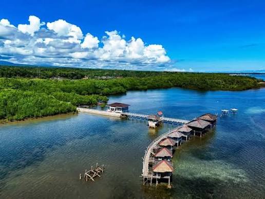
A public beach destination along the Sinacaban shoreline providing open beachfront space, calm ocean waters, and seaside picnic spots.
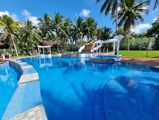
A private beachfront establishment along the Baliangao shoreline providing basic seaside cottages, clear waters for swimming, and quiet picnic facilities.
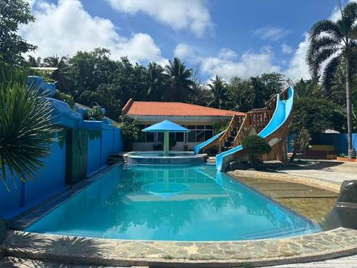
A coastal establishment in Lopez Jaena operating floating cottages off the shoreline, providing private bamboo raft rentals for day swimming and seaside family gatherings.
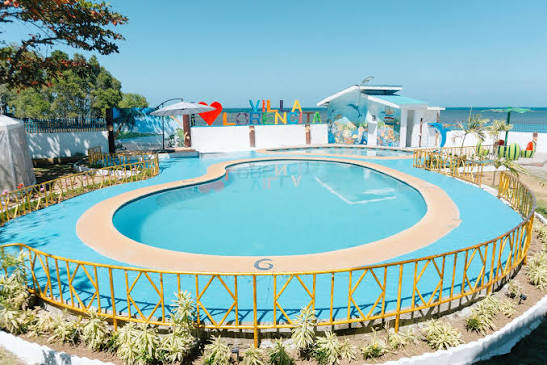
A beachfront cottage and resort setup in Clarin offering shaded seaside picnic shelters, swimming access, and room stay options.
2 destinations
A historic 18th-century Spanish stone fort (Fuerte de la Concepción y del Triunfo) built in 1756 along the coast of Ozamiz City to protect Panguil Bay against pirate raids. Declared a National Cultural Treasure, it houses an official museum displaying colonial artifacts, military relics, and regional history exhibits.
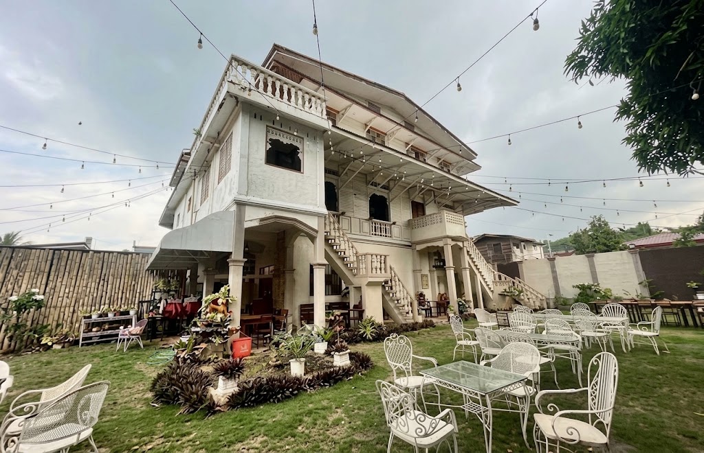
A landmark ancestral house built in 1914 situated within the heritage town of Jimenez. Formerly housing the historic Bacarro Printing Press, it currently serves as a museum displaying vintage artifacts, historic printing equipment, and period furniture, alongside a heritage dining area.
6 destinations
A flagship 191-hectare highland eco-tourism park situated along the Mt. Malindang mountain range. Formerly known as the Hoyohoy View Deck area, it features themed international botanical gardens, cool foggy mountain weather, scenic walking paths, glass walkway features, local souvenir shops, and panoramic views of Panguil Bay and sea-of-clouds.
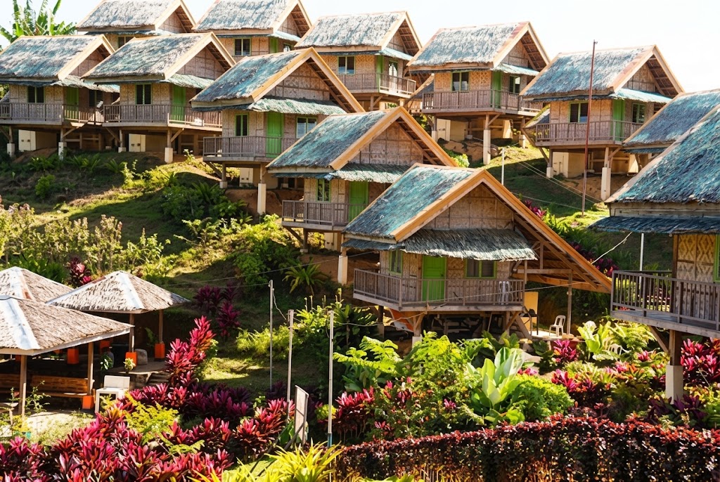
A premier municipal highland resort and eco-park in Tudela. Offers mountain vistas, freshwater swimming pools, traditional Japanese-style Kawa hot baths, overnight accommodations, and function venues.
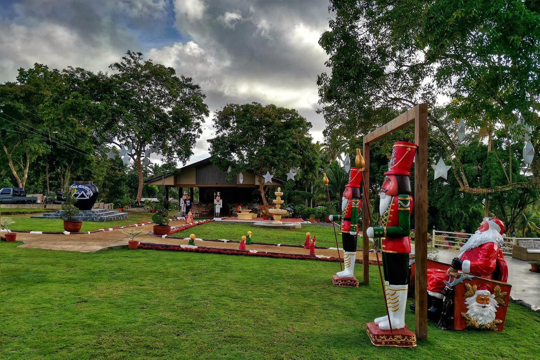
An upland agri-tourism farm resort and viewpoint area situated in the elevated barangays of Aloran. Features fresh mountain breeze, swimming pool amenities, overnight cottage accommodations, and scenic views of surrounding hills.
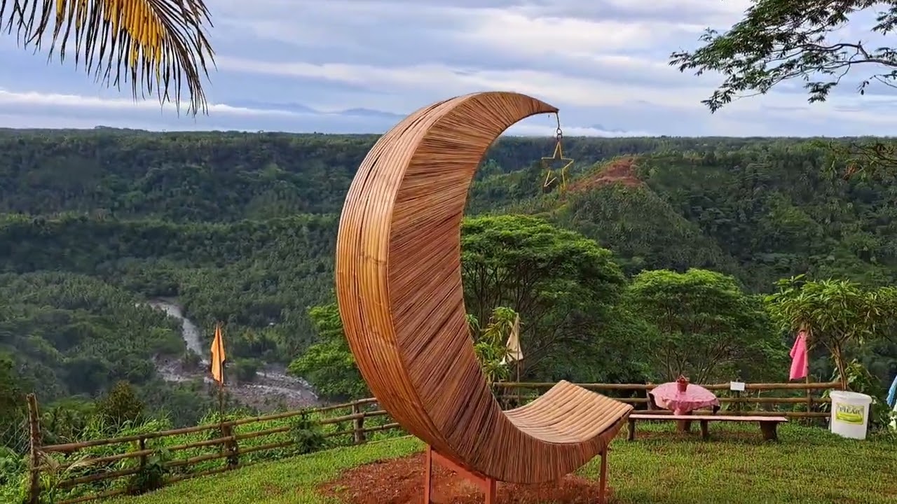
A hilltop view deck and picnic retreat in Jimenez. Situated on an elevated ridge, it offers panoramic views of lush green rolling hills, cool mountain air, viewing platforms, and quiet picnic gazebos.
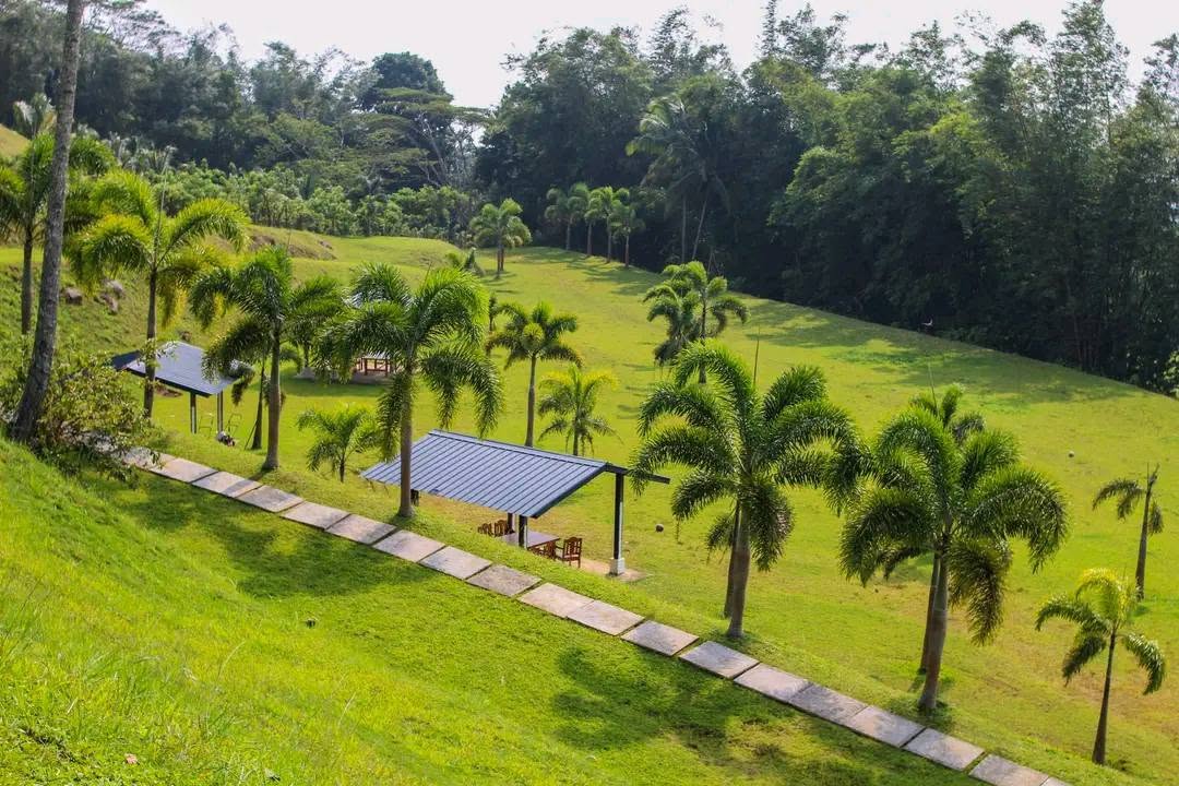
The Green Tops is a scenic destination in Banglay, Tangub City, located near the foothills of Mt. Malindang. It offers views of Panguil Bay and is described as a spot suitable for picnics, family visits, and enjoying the surrounding scenery.
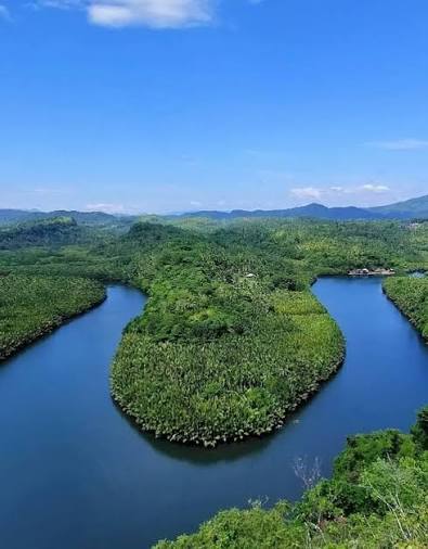
A scenic highland viewpoint area overlooking the natural U-shaped bend of the local river and surrounding rolling green hills in Baliangao. Popular for quick photo stops and panoramic landscape views.
6 destinations
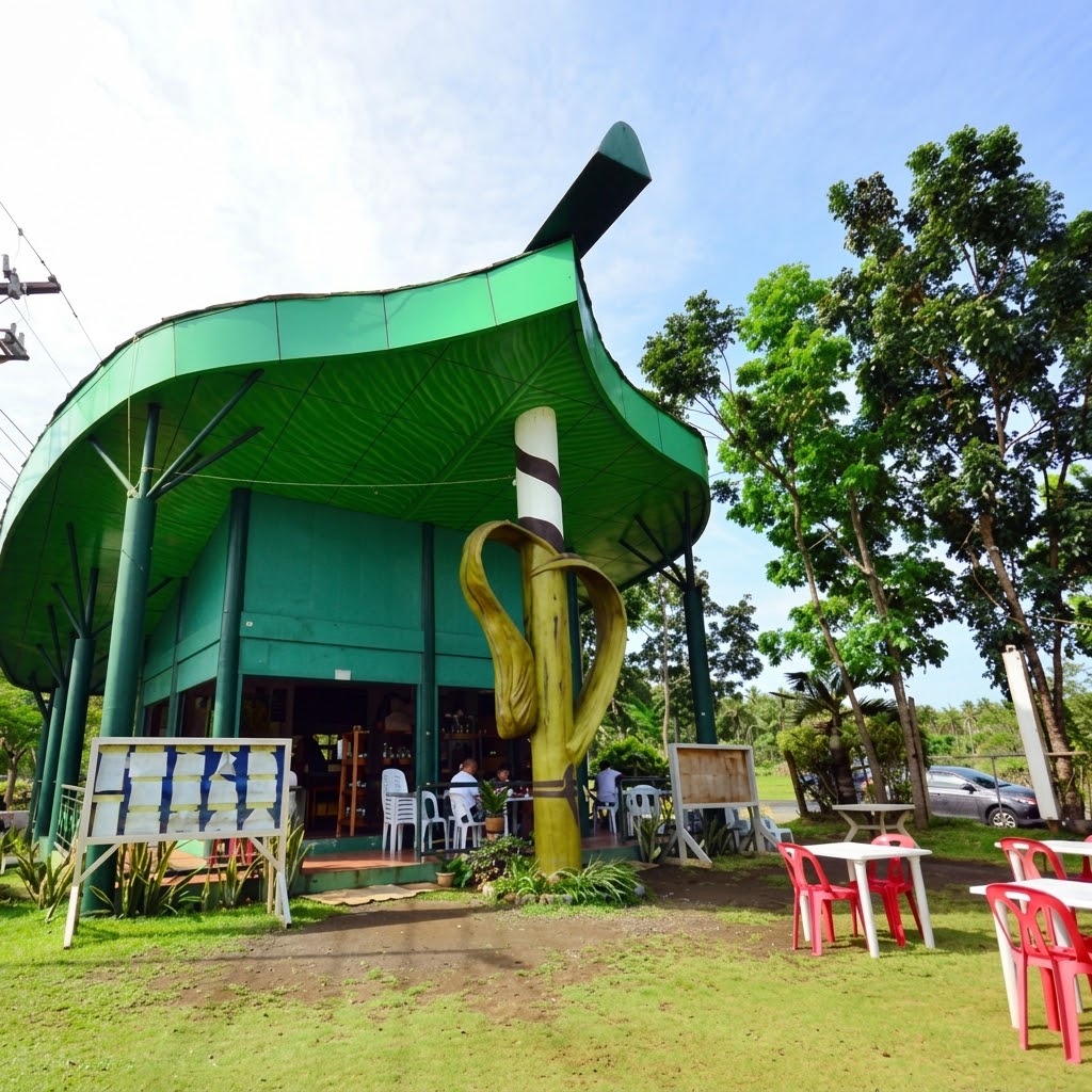
The flagship municipal culinary and pasalubong center of Clarin — the "Suman Capital of Misamis Occidental." It sells famous local delicacies, primarily Suman sa Clarin (glutinous rice cooked in coconut milk wrapped in banana leaves in flavors like chocolate, mango, and jackfruit), paired with native hot sikwate, along with regional handicrafts.

A major urban park and coastal promenade located near the Ozamiz port area. Features open-air exercise equipment, walking/jogging paths, food kiosks, souvenir stalls, religious item shops, and night market dining overlooking the bay.
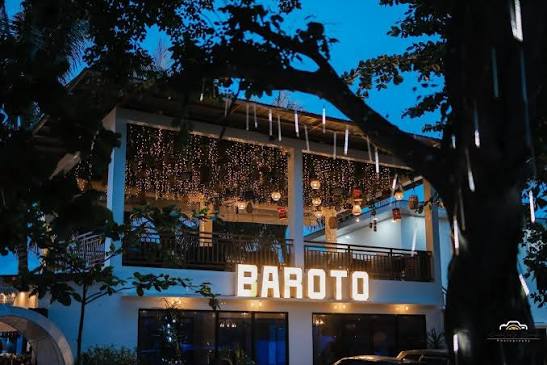
An event venue in Jimenez offering swimming pool access, function spaces, and accommodation for private parties, reunions, and gatherings.
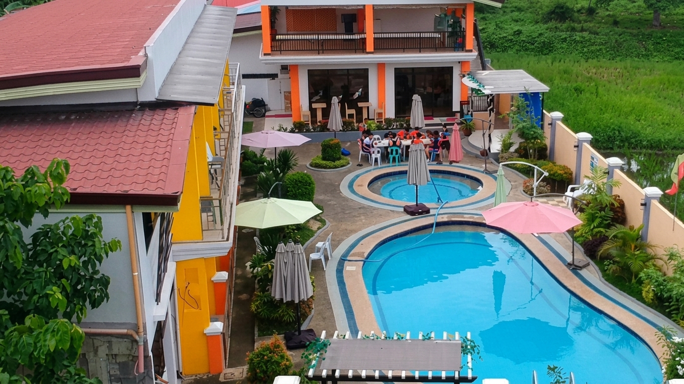
A local private establishment in Jimenez providing swimming pool access, pension rooms, and venue space for private social gatherings and events.
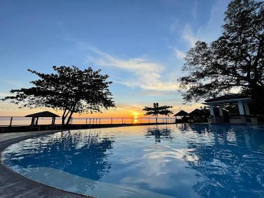
A private inland pool resort and event space in Clarin offering a clean freshwater swimming pool, private rooms, and shaded poolside huts for family stays and day outings.
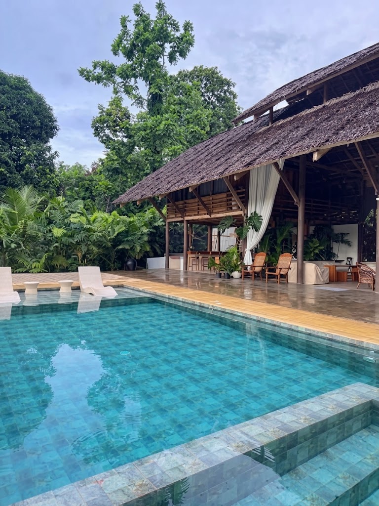
A private event villa and pool facility in Panaon providing gated function venues, swimming pool access, and accommodation packages for exclusive family gatherings, birthdays, and private events.
3 destinations

A 9-hectare flower farm and agri-tourism destination situated 5.5 km (a 10-minute drive) from Tangub City proper. Features vibrant flower fields, an 8.3-hectare dragon fruit farm, scenic photo spots, and Japanese-style Kawa Hot Bath spas (Turmeric, Coffee, Sea Salt, Milk, and Activated Charcoal baths).
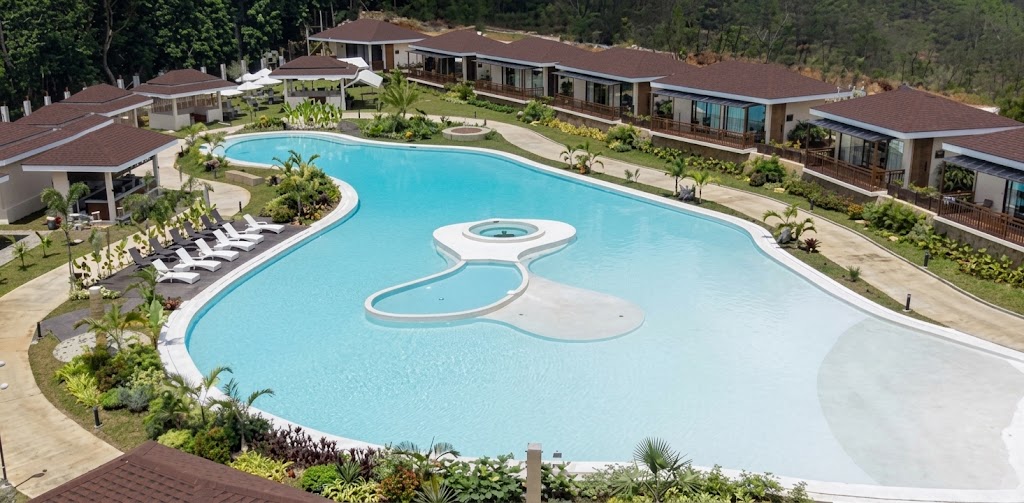
Kenjelo Farm and Recreation Resort is a farm and recreation destination in Dolipos Alto, Oroquieta City, Misamis Occidental. It features a scenic farm environment with mountain views, landscaped areas, accommodations, and recreational facilities. The resort combines nature, relaxation, and adventure activities.
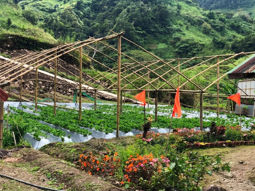
A high-altitude agri-tourism attraction situated at the cool foot of Mount Malindang. Earned Don Victoriano the title "Baguio City of Northern Mindanao," offering strawberry picking, fresh strawberry products (jams, shakes), and photo ops amidst mountain ridge views.
3 destinations
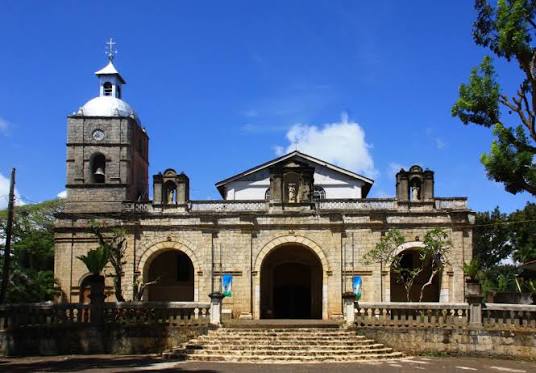
A magnificent 19th-century Spanish colonial church constructed in 1880 out of coral stone and lime mortar. Recognized as a National Cultural Treasure by the National Museum of the Philippines, it features original bamboo ceiling paintings and antique woodwork.
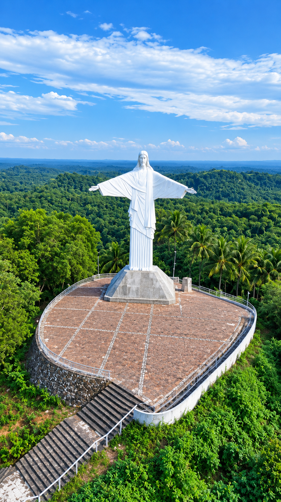
A major religious landmark and highland viewpoint situated atop a hill in Sapang Dalaga. Features a massive 45-foot open-armed statue of Jesus Christ (inspired by Rio de Janeiro's Christ the Redeemer) offering panoramic views of Murcielagos and Casamutan Bays. Reached by a 197-step concrete staircase.
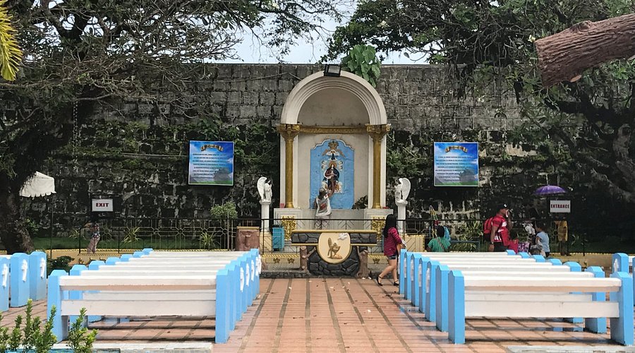
A revered open-air Marian shrine located on the outside wall of the historic Cotta Fort facing Panguil Bay. Famous for the miraculous carved image of Our Lady of the Immaculate Conception (Nuestra Señora de la Concepción del Triunfo), attracting pilgrims nationwide.
1 destination
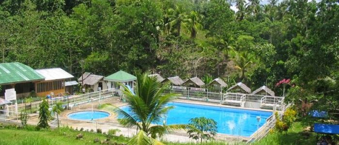
A resort welcoming visitors with clean, fresh spring water across two swimming pools, plus function spaces for family reunions, meetings, and other gatherings, with inn rooms for overnight stays.
5 destinations
A hidden natural waterfall surrounded by dense tropical foliage, lush greenery, and fresh mountain air in Oroquieta City. Reached via a scenic concrete staircase trail of over 300 steps down to the natural cold swimming basin.
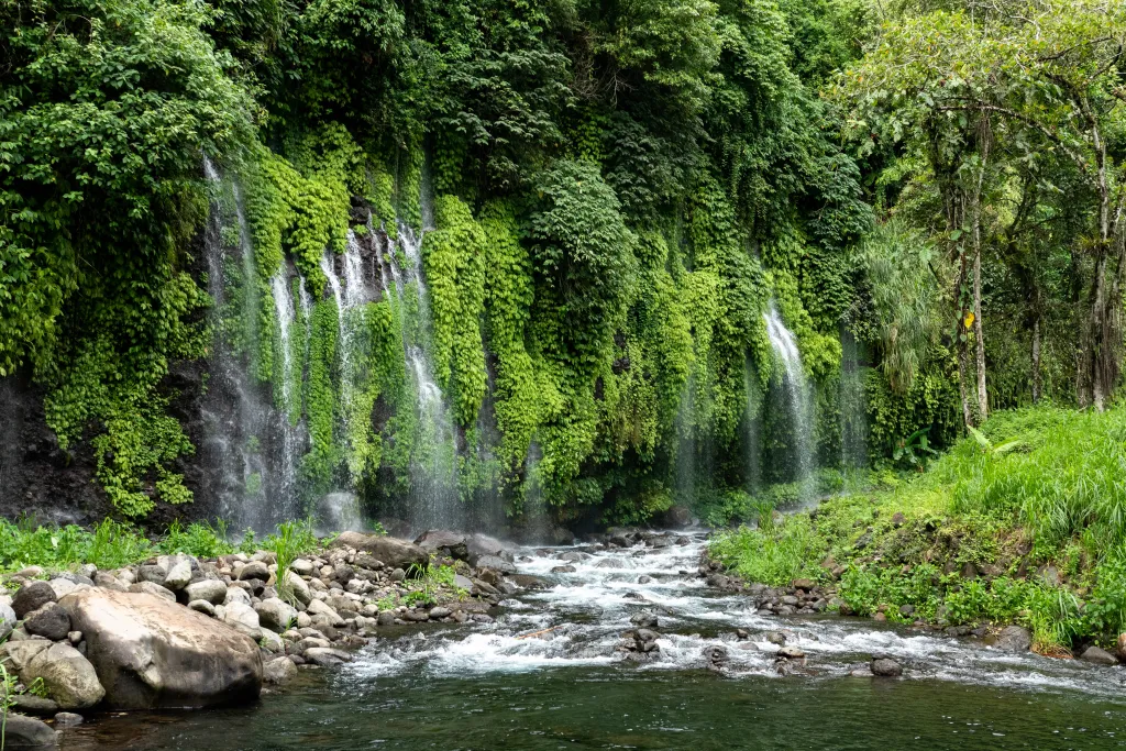
A curtain-like natural waterfall hidden in the rainforest slopes of Mt. Malindang. Features massive volumes of rushing cold spring water cascading down steep boulder formations into a natural swimming pool.
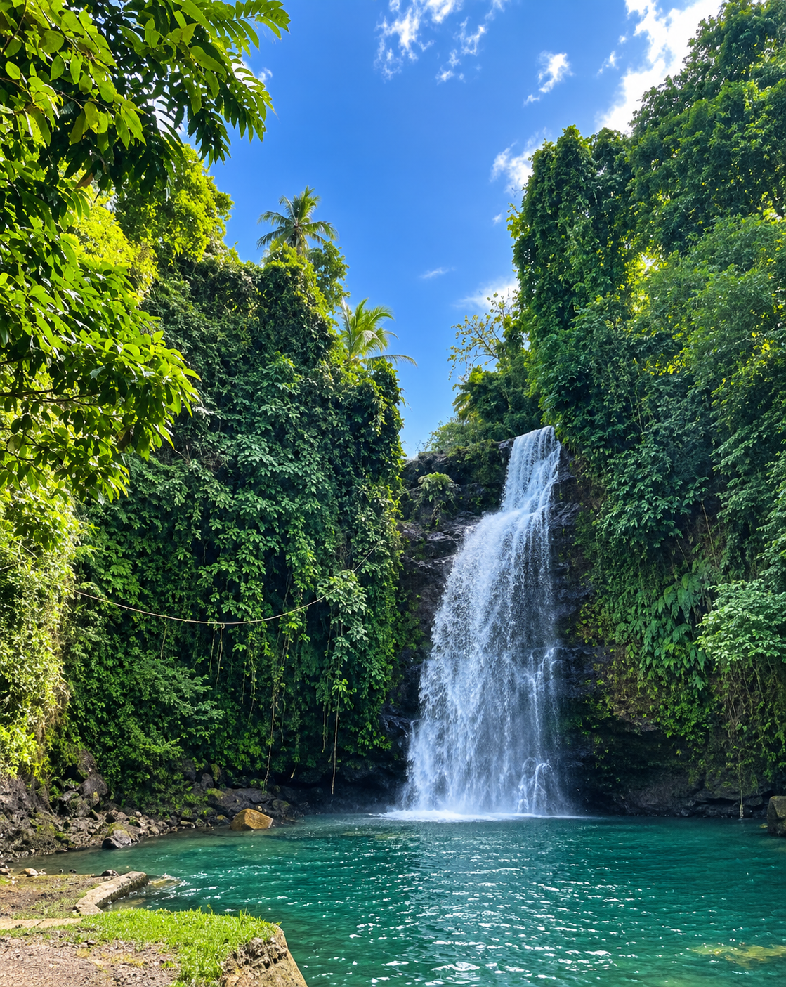
A 60-foot natural waterfall located just 1 kilometer from the town proper of Sapang Dalaga. Features a deep natural swimming basin fed by cool mountain waters, concrete viewing decks, function spaces, picnic huts, and a 197-step access staircase.
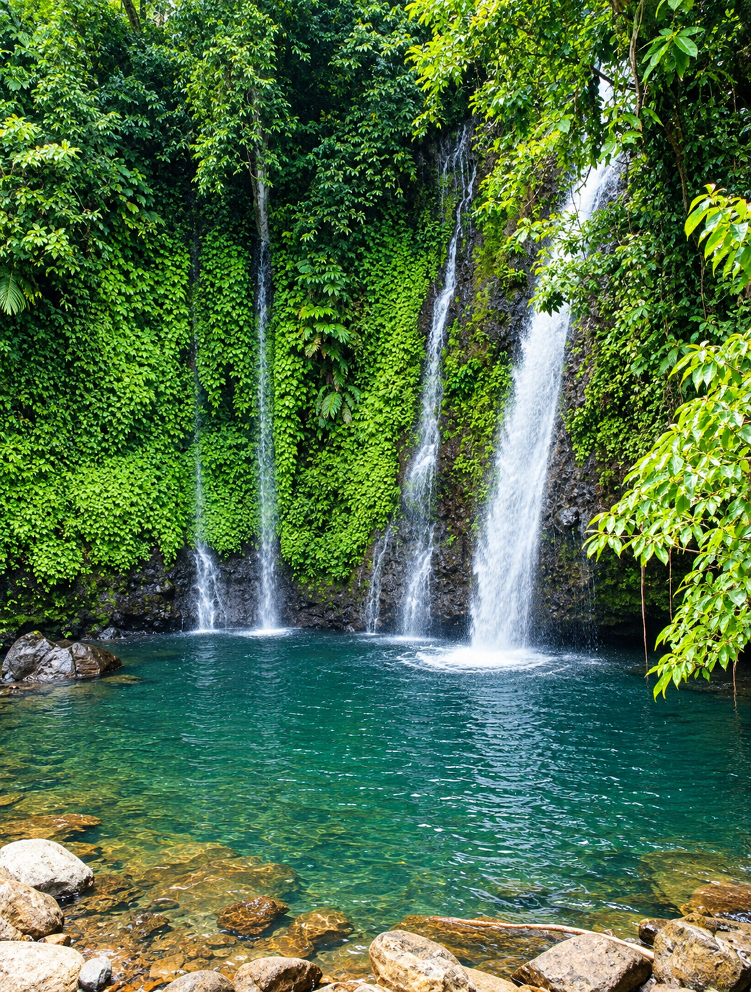
A majestic natural waterfall located in the highland municipality of Concepcion. Cascading down approximately 25 meters within a lush jungle basin, it feeds cold mountain river streams surrounded by dense foliage and pristine rock formations.
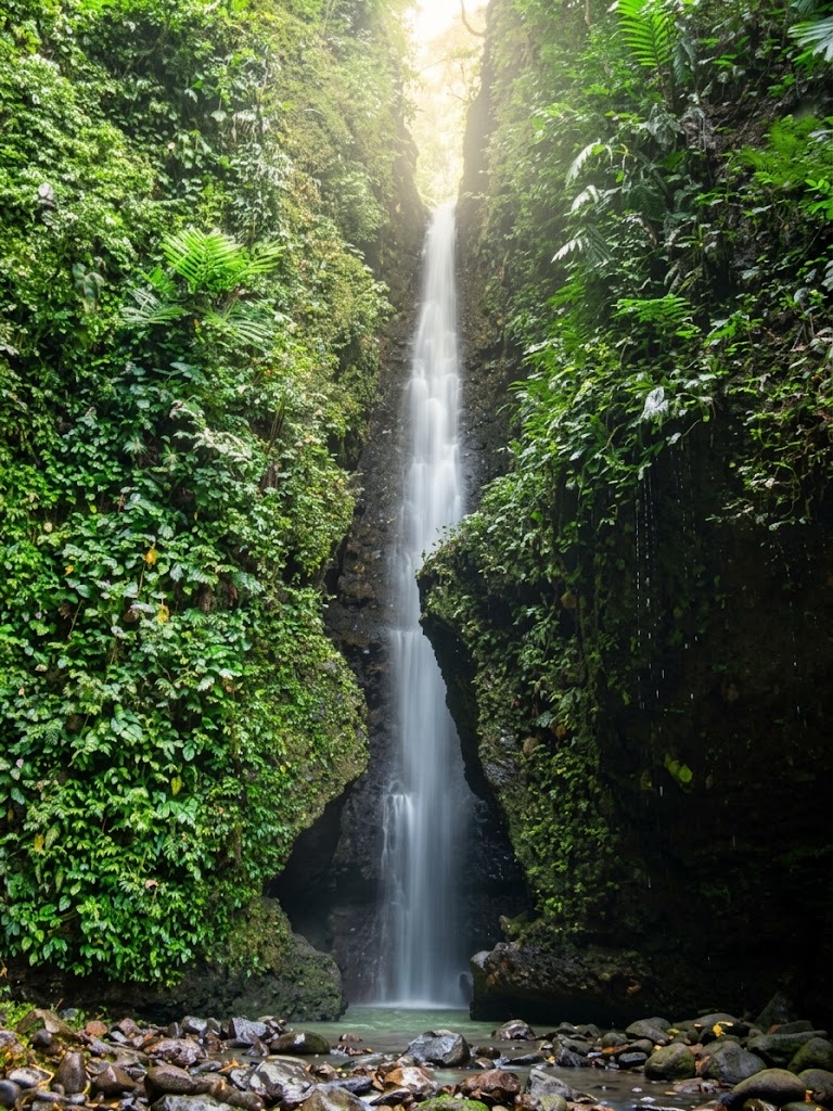
A natural waterfall hidden within a deep ravine in Calamba, featuring cascading cold waters, natural rock basins for swimming, and lush surrounding flora.
4 destinations
An eco-adventure mangrove paddling tour along the river streams and coastal mangrove estuaries of Oroquieta City. Provides visitors with guided mangrove kayaking experiences, ecological education, and river swimming.
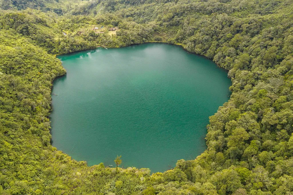
A mystical crater lake nestled high within the protected Mt. Malindang Range Natural Park. Revering pristine waters held sacred by the indigenous Subanen people, the lake is enveloped by mossy rainforests and rare highland biodiversity.

An eco-tourism lake attraction created by an earth dam situated 10.5 km from Calamba town center. Nestled between green mountains, it offers water activities like kayaking, pedal boating, water biking, floating cottages, and scenic mountaintop vistas.
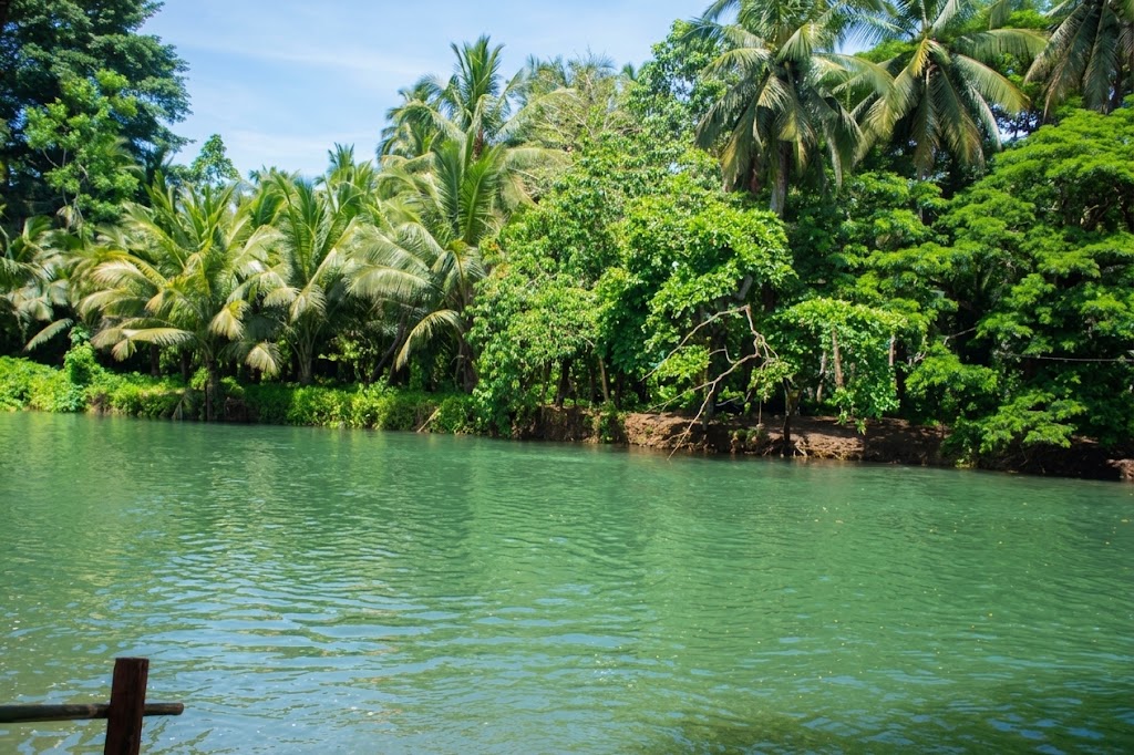
An inland eco-river attraction providing visitors with fresh river swimming, shaded picnic cottages along the riverbanks, and fun river tubing activities.
Four steps from your travel dates to a scheduled, mapped route across Misamis Occidental.
Enter your travel dates, daily schedule, starting location, preferred attraction types, and activities.
View personalized destinations that meet your trip requirements, ranked based on your preferences.
Select destinations and generate a feasible day-by-day itinerary based on travel time, operating hours, visit duration, and other constraints.
View the itinerary and map route, track destination progress, and complete or skip stops as you travel.
Day 1 of 3 · Tue, Nov 3 · Ozamiz
Day 2 of 3 · Wed, Nov 4 · Tangub
Day 3 of 3 · Thu, Nov 5 · Jimenez
my_location Starting location: Ozamiz City
Set out from Ozamiz City
By road · 4 min · 1.8 km
Asenso Ozamiz Wellness Park
Leisure · Park · 30m visit
By road · 11 min · 0.4 km
Cotta Fort/Museum
Heritage · Historic · 30m visit
By road · 11 min · 0.1 km
Cotta Shrine (Birhen Sa Cotta)
Religious · Shrine · 30m visit
Overnight stay near Cotta Shrine (Birhen Sa Cotta)
8h 4m free before your day ends
Set out from your overnight stay near Cotta Shrine (Birhen Sa Cotta)
By road · 23 min · 19.1 km
The Green Tops
Highland · Viewpoint · 30m visit
By road · 36 min · 2.8 km
Asenso Global Gardens
Highland · 1h 30m visit
By road · 52 min · 16.7 km
Panguil Bay Bridge
Coastal · Landmark · 30m visit
Lunch Recommendation
Near Panguil Bay Bridge
Overnight stay near Panguil Bay Bridge
4h 38m free before your day ends
Set out from your overnight stay near Panguil Bay Bridge
By road · 52 min · 41.8 km
Church of St. John the Baptist
Religious · 30m visit
By road · 11 min · 0.2 km
Casa Bacarro Museum
Heritage · 30m visit
By road · 50 min · 10.8 km
Gulod Lantawanan
Highland · Viewpoint · 30m visit
Lunch Recommendation
Lunch at Asenso Misamis Occidental Recreation & Adventure Park (AMORAP) (restaurant) on the way to Ozamiz City - about 2 min off the direct route.
By road · 22 min · 14.1 km
Back at Ozamiz City
4h 46m free before your day ends
A real plan for Tue, Nov 3, 2026, built by the same engine that plans your trip. Every leg keeps a buffer for parking and walking in - up to 30 minutes, less where the travel estimate already covers it.
Pasyal is a trip planner for Misamis Occidental. Every destination it can send you to is kept here with its own location, opening hours, entrance fee, how to get there and how long a visit takes — across 10 types of attraction, from coastal spots and waterfalls to highlands, heritage houses and churches. That catalogue is what the planner builds your schedule from, and what the figures below count.
Everything you need to know about planning your trip with Pasyal.
PasyalMisocc is a smart trip planner for Misamis Occidental. You pick your dates and interests, and it builds a day-by-day itinerary across the province's beaches, waterfalls, heritage sites and more, complete with a route map, travel times and lunch stops.
You can browse destinations and their details without an account. To plan a trip, save itineraries, keep favorites, rate places or track your progress, you need a free account. Click Sign Up in the top menu to create one.
Click Login in the top menu (on mobile, open the ☰ menu first). Enter your username and your password, then sign in. You will be taken to your dashboard.
Use the Plan a Trip bar at the top of this page or go to Plan My Trip. Set your start date and number of days, choose your starting location (GPS or typed in), pick the attraction types you like, then select the destinations you want. The system generates your itinerary from there.
A rule-based engine arranges your stops. It automatically decides how many destinations can realistically fit each day, groups nearby places, adds a buffer to every drive, fits visits within opening hours, keeps outdoor spots away from the midday heat, adds lunch when a day runs past noon, and makes sure there is time to get back at the end of each day.
From the homepage planner you can plan trips of 1 to 7 days. Pick the destinations you want, and the system schedules only what can realistically fit within your selected days and hours. Your stay can be day trips (heading home every evening) or overnight stays where the next day starts from your accommodation.
Yes. Open the itinerary and use Adjust / rearrange itinerary to reorder stops. You can also Skip a stop or lunch, or use Find Alternatives to swap a destination for a similar one nearby.
Destinations that are temporarily unavailable are flagged on your itinerary, and you can find alternatives in one tap. Each day shows a weather forecast (available up to 15 days before the date), and heavy rain brings up indoor alternatives.
Your itinerary map shows the route and travel times by Car, Motorcycle or Walk. Switch between them on the itinerary page, or tap Start navigation to head to the next stop.
On your itinerary, tap Complete destination as you finish each stop. Your progress is saved day by day, and when the whole trip is done you can rate how it went.
Sign in to your account, then tap the heart icon on any destination on your dashboard. Your saved places appear under My Favorites for quick access when planning your next trip.
Go to My Itineraries to see every trip you have planned. From there you can open, filter or delete them. You can also use Export PDF on an itinerary to keep an offline copy.
Sign in to your account, open any destination on your dashboard, and go to the Rate & contact tab. Tap a star to rate it and leave a comment about your visit to help other travelers.